
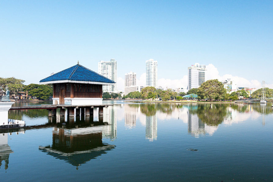
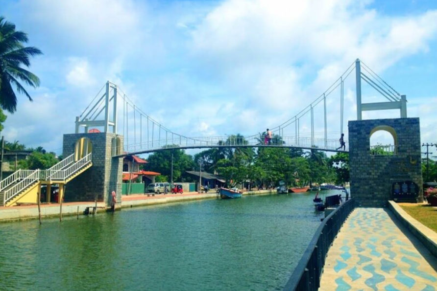
Beira Lake is a lake in the center of the city of Colombo in Sri Lanka. The lake is surrounded by many large businesses in the city. It initially occupied approximately 1.65 km2 (0.64 sq mi) of land 100 years ago and this has since been reduced to 0.65 km2 (0.25 sq mi) today due to various reasons. During the colonial era of the Portuguese, Dutch and the English the lake was used for a wide variety of purposes. It still retains its Portuguese name. It is connected to many intricate canals which provided an easy way of transporting goods within the city and suburban cities.
Author: admin
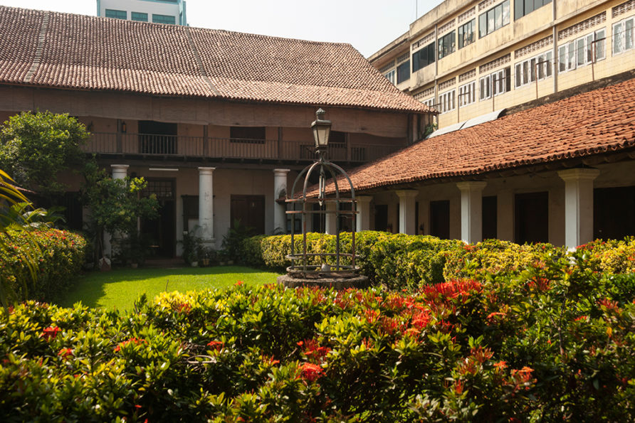
Colombo Dutch Museum
The two story colonnaded building on Prince Street, Pettah (Colombo 11) which houses this museum was constructed during the Dutch occupation of Colombo (1656 – 1796) and was the formal residence of the Governor of Dutch Ceylon Thomas van Rhee (1634 – 1701) during his term of office in 1692 to 1697. The building has been used for many different purposes over the years. It was a teacher training college and an institute for the instruction of clergymen between 1696 and 1796. At one time it was the residence of Colonel Count August Carl Fredrick Von Ranzow (1759 – 1844). It operated as an orphanage under the supervision of the deacons and financed by the Dutch East Indies Company. It was also used as a hospital. It became a barracks in the second half of the 1800s and in 1900 it was used as a police training school, set up by the British. In 1932 it was converted to the Pettah Post Office. In 1971 following heavy monsoon rains one of the exterior walls collapsed and the building was abandoned. Following protests by the Royal Asiatic Society and the Dutch Burgher Union against plans to demolish the building, in 1973 a committee was established with representatives from the Ceylon Tourist Board, the Department of Archaeology, the Netherlands Alumni Association of Lanka and the National Archives, to restore the building and establish a museum covering the Dutch colonial period. The restoration of the building commenced in 1977, with financial assistance of Netherlands government, and was completed in 1981. This museum was opened to the public in 1982. This building embodies the unique architectural features of a colonial Dutch town house. In 1999 the museum building was formally recognised by the Government as an archaeological protected monument in Sri Lanka. The designation was declared on 18 June under the government Gazette number 1085. The museum while displaying the Dutch legacy with the artefacts including furniture, ceramics, coins and weaponry, portraying the various facets of contemporary life and culture.
Viharamahadevi Park
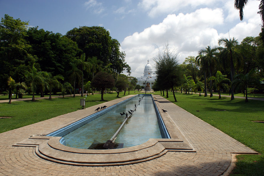
Viharamahadevi Park (formerly Victoria Park) is a public park located in Cinnamon Gardens, Colombo, situated in front of the colonial-era Town Hall in Sri Lanka. It was built by the British colonial administration and is the oldest and largest park of Colombo. The park was originally named “Victoria Park” after Queen Victoria but was renamed after Queen Viharamahadevi, the mother of King Dutugamunu following independence. During World War II it was occupied by the British Army with Australian 17th Brigade based at Victoria Park. After the war the park was restored and open to the public in 1951. There used to be a cricket ground in the park, which was used for first-class cricket between 1927 and 1995. Ceylon played against a touring English team there in 1927 and against an Australian team in 1935. Viharamahadevi Park The park features include a huge Buddha statue which replaced the statue of Queen Victoria which originally stood there, and a series of water fountains. It also includes a mini zoo, a children’s play area and a BAC Jet Provost. There are Muscovy ducks in the park. They swim in the artificial lake and walk on the grass beside it. Viharamahadevi Park is the only large-scale public park in Colombo, and is maintained by the Colombo Municipal Council. Located at its western end is the Cenotaph War Memorial, Colombo and the Colombo Public Library. The Vihara Maha Devi Park Open Air Stadium is a venue for concerts and public events.
Muthurajawela Marsh
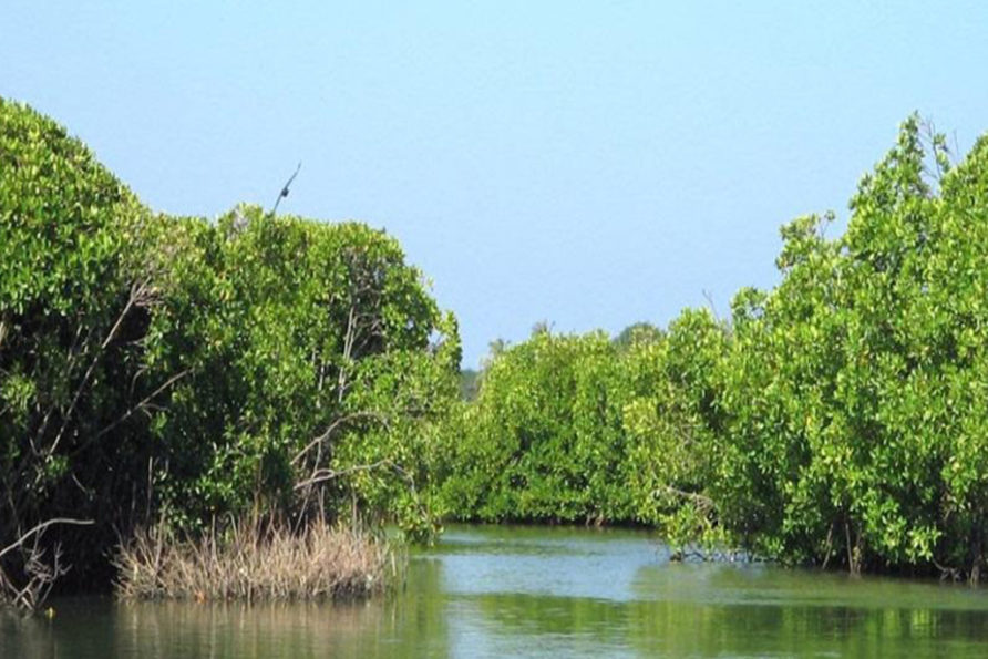
Muthurajawela is a marsh in Sri Lanka in the southern region of the Negombo lagoon, 30 km (19 mi) north of Colombo. The Muthurajawela Marshes are 3,068 ha (7,580 acres) in area and the country’s largest saline coastal peat bog. The marsh is notable for its unique and highly diverse ecosystem and is listed as one of 12 priority wetlands in Sri Lanka. “Muthurajawela” translates to “Swamp of Royal Treasure”. The marsh is believed to have originated about 7,000 years ago. In 1996 1,777 ha (4,390 acres) of the northern part of the Muthurajawela marsh was declared a wetland sanctuary by the government, under the Flora and Fauna Protection Act, in recognition of its vast bio-diversity. The region supports 192 distinct species of flora and 209 distinct species of fauna, including Slender Loris, as well as another 102 species of birds. Some of the identified species have been shown to be indigenous to the marsh. The marsh is a major local and tourist attraction, primarily for sightseeing and boating tours, and the area also supports local agriculture and forestry. Visitors to the region are guided through the sanctuary areas by the staff of the Muthurajawela Marsh Centre to avoid serious harm to the marsh ecosystem.
Hamilton Canal
The Hamilton Canal (also commonly known as the Dutch Canal) is a 14.5 km (9.0 mi) canal connecting Puttalam to Colombo, passing through Negombo in Sri Lanka. The canal was constructed by the British in 1802 and completed in 1804. It was designed to drain salt water out of the Muthurajawela wetlands. The canal was named after Gavin Hamilton, the Government Agent of Revenue and Commerce.
Kelaniya Buddhist Temple
The Kelaniya Raja Maha Vihara or Kelaniya Temple is a Buddhist temple in Kelaniya, Sri Lanka, seven miles from Colombo. The Chief Incumbent (Chief Priest) is Venerable Professor Kollupitiye Mahinda Sangharakkhitha Thera. The temple has often been associated with the rise and fall of Ceylon / Sri Lanka, with the popular saying that as the Kelaniya temple rose, Sri Lanka rose and as it fell, the country and its administration fell. It has thus had a deep association with the political powers of the country. It is also infamous for Mapitigama Buddharakkitha, the chief conspirator of the 1959 assassination of Ceylon’s fourth Prime Minister S. W. R. D. Bandaranaike. Buddharakkitha was the chief incumbent (chief priest) of the Kelaniya Raja Maha Vihara from 1947 to 1959
Negombo Lagoon
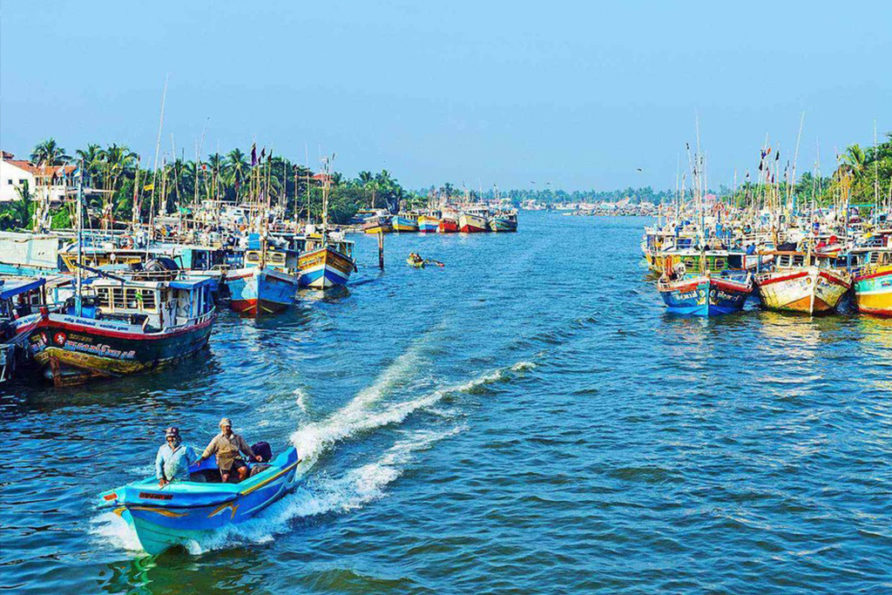
Negombo Lagoon is a large estuarine lagoon in Negombo, south-west Sri Lanka. The lagoon is fed by a number of small rivers and a canal. It is linked to the sea by a narrow channel to the north, near Negombo city. It is surrounded by a densely populated region containing rice paddies, coconut plantations and grassland. The land is used for fishing and agriculture. The lagoon has extensive mangrove swamps and attracts a wide variety of water birds including cormorants, herons, egrets, gulls, terns and other waders. Negombo, Katunayake, Seeduwa are some nearby towns. Lagoon fishing is popular among the fishing community in Negombo. Lagoon crabs and lagoon prawns are in high taste and demand.
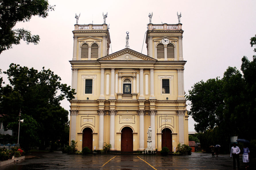
St. Marys Church Negombo
The St. Mary’s Church, Negombo is landmark edifice, a Roman Catholic church in the heart of Negombo. Its exterior surface is painted in pink colour. It is one of the largest cathedrals in Sri Lanka.
Negombo has been influenced greatly by the Christian faith from the time it was occupied by the Portuguese. It is often called “Little Rome” in view of the large number of churches in the city. Construction of the church was started in 1874 and completed, after a long gap, in 1922. The art and architecture of this church and a few similar other churches in Sri Lanka demonstrate the cultural amalgamation of the European practice with Sri Lankan art and architecture during the early years of the 20th century.
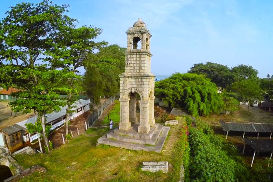
Dutch Fort in Negombo
Negombo Fort was a small but important fort in Negombo, approx. 30 km (19 mi) north of Colombo, that was built by the Portuguese to defend Colombo. 1665 Map of Negombo fort In its time the fort at Negombo was probably the next in strategic importance after Colombo, Jaffna and Galle. The original Portuguese fort was a weak structure, which, according to the account of João Ribeyro; “Negombo was only a square enclosed by walls, with two redoubts and five guns. A Captain and a few men, with a Chaplain were stationed there” It was captured by Dutch forces commanded by Philip Lucasz, in February 1640. The Portuguese made several attempts to retake it before they were successful in December 1643. They then strengthened the fortifications and managed to defend the fort until it was recaptured by the Dutch under the command of François Caron, in January 1644. The original bastions were destroyed by the Dutch cannons during the siege of the fort. The Dutch subsequently rebuilt it in 1672 however not on the usual square pattern, but on a pentagonal one, though it had only four bulwarks, the fifth was never constructed (possibly due to the cost). The fort was located on a narrow strip of land between a lagoon and an inlet of the sea. It was surrounded by a dry moat, and the gate was accessed via a drawbridge. In February 1796 it was occupied by the British without opposition. In the late 1800s the British authorities decided to demolish the fort and build a prison in its place, constructed from the stones of the fort. Today all that remains is a section of the eastern rampart with mounds at its northern and Southern ends, where the previous bastions existed, and an recessed arched gateway. Above the gateway is a slab of granite, with the date 1678 inscribed, surmounted by a high decorative gable. The site is still used as a prison by the Department of Prisons.